

Tracks4Africa is proud to announce the first edition of our Zambia Self-drive Guide. This book follows the same recipe as our Botswana and Namibia self-drive guides and you can expect more than 400 A4 pages packed with objective travel information.
Tracks4Africa is proud to announce the first edition of our Zambia Self-drive Guide. This book follows the same recipe as our Botswana and Namibia self-drive guides and you can expect more than 400 A4 pages packed with objective travel information.
The guide is designed to provide the self-drive traveller with information on how to prepare for a trip to Zambia, planning routes and destinations and to be used on the road. The guide is enhanced with the use of many detailed maps and includes a complete road atlas of Zambia.
Printed in full colour, the guide includes hundreds of photographs which makes it an interesting read for any person dreaming of visiting Zambia.
Our staff has visited all destinations presented in the book and our maps are ground-truthed by countless travellers who have travelled all roads in Zambia. Our presentation of destinations and accommodation is objective, leaving the traveller with facts rather than opinion.
![]()
Tracks4Africa maps are built for the self-drive traveller and is packed with information that will enable you to plan your next adventure. The Tracks4Africa Zambia paper map is designed to be used in conjunction with the T4A GPS Map of Zambia.
The map scale is 1:1 000 000 which gives you enough detail but also allows for an overview of the country. The map is printed on PolyArt which is tear and water resistant and will survive your adventures with you.
This Tracks4Africa paper map series are probably the first comprehensive country maps in the world, offering travel time information for the entire road network, be it on tar, gravel or sand!
Tracks4Africa CEO, Johann Groenewald, has spent the last nine years exploring all corners of this evergreen country and fell in love with its unspoilt beauty.
The Tracks4Africa paper map of Zambia was bound to be published sooner or later. We updated our GPS maps for years on end and have send in many research parties to update the minor roads and tracks in the parks of Zambia. This 1:1million scale map of Zambia is now the most up to date printed map for the self-drive traveller available.
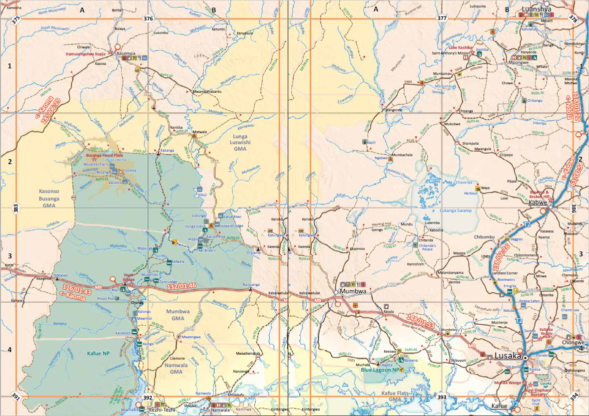
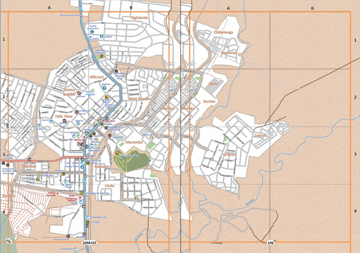
You will find that all major and minor roads are included together with a vast network of minor gravel and off-road tracks in the rural areas. All national parks and game reserves are covered and more prominent parks such as the Kafue, Liuwa Plain and South Luangwa has detailed inserts. We have also shown the locations of major tourist attractions and land marks.
Zambia’s country shape does not lend itself to be printed on one side of a our standard paper size. We aim to bring a lot of detail into our maps and therefor we print country maps on a scale of 1:1 million which necessitates the country to be split in east and west sides and printed on both sides of the paper.
This allows enough additional space to include the very popular areas adjacent to Zambia such as Katima Mulilo in Nambia, Kasane and Chobe in Botswana, Victoria Falls and Mana Pools in Zimbabwe.
• Large 1:1,000,000 scale (large double-sided map)
• Travel times and distances shown on roads
• Large paper map, printed on both sides folds down to easy to use size. Packed in a plastic sleeve for extra protection.
• What you see on the paper map is exactly what you get on T4A GPS Maps
• Comprehensive set of roads and tracks in nature reserves
• Map designed to suit the needs of self-drive travellers
• Border crossings indicated with opening and closing times
• Visit www.tracks4africa.com for detail on places of interest
• Printed on tear and water resistant PolyArt paper suitable for outdoor use
• Shaded relief background
The roads, tracks, places of interest as well as the distance data and travel time estimates on the map reflect the collective travel experience of the Tracks4Africa community of travellers over the past 10 years, with every single road being GPS recorded and verified by this community.
In addition to this the Tracks4Africa research team has also driven every major road and visited every single park in the country to verify details.
No need to transfer GPS coordinates from the map to your GPS as everything you see on the map is contained in our T4A GPS Maps. Use T4A GPS Maps to navigate you to all the destinations you see on this country map.


Tracks4Africa is proud to announce the first edition of our Zambia Self-drive Guide. This book follows the same recipe as our Botswana and Namibia self-drive guides and you can expect more than 400 A4 pages packed with objective travel information.
